DofE Expedition Maps That Don't Fail in the Rain
Bespoke laminated OS maps made around your expedition area - durable enough to be reused year after year.
One Working Map for the Area Your Expedition Actually Uses
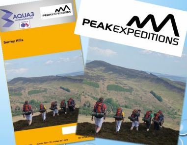
- 1:25,000 mapping is the normal DofE choice, with 1:50,000 also available
- Map the expedition area you actually need - either tell us your route and Aqua3 will help choose the coverage, or centre the map yourself
- Bring mapping across 2 or 3 conventional OS sheet areas together where the route crosses sheet boundaries
- Aqua3's Ordnance Survey mapping data is updated every 6 months
- Magnetic information is taken from the current British Geological Survey (BGS) data set
- Printed on specialist synthetic media and laminated for repeated all-weather use
- Every map carries a unique Aqua3 Map ID to make repeat ordering simple
- Sample DofE maps available on request

Popular folded DofE formats: £22.99 - £24.99, including delivery.
Not sure where to centre the map?
Enter your start, finish and places you pass through. Aqua3 will estimate the area you need and suggest suitable map formats.
Plan My Expedition Map
Already know the exact area you want?
Use the normal centred-map option to choose the map area yourself.
I Already Know My Map Area
Learn more about Aqua3 maps | Help/FAQ
No School Payment Card? Order by Invoice
You do not need an existing Aqua3 account. Schools, colleges, youth organisations and other approved organisations can complete the map order online and choose School / Organisation Account Order in the basket.
1. Create the mapChoose the area, scale and personalisation you need.
2. Go to the basketYour map specification stays with the order.
3. Choose account orderSelect School / Organisation Account Order.
4. Submit your detailsNo online payment is taken.
5. Aqua3 invoices youWe receive the complete order and issue the invoice.

A3+ - A Lower-Cost Option for Smaller Expedition Areas
Two-sided custom OS mapping for £8.99 including delivery.
A3+ can be a very useful option for Bronze expeditions, practice walks and youth-group activities where the required mapping will fit across the two independently positioned sides.
- Custom mapping on both sides
- Available at 1:25,000 or 1:50,000
- Landscape or Portrait can be chosen independently for each side
- Laminated Aqua3 all-weather map
- A lower-cost choice when a larger expedition map is not required
Not every expedition area will fit A3+. Use the Route Finder and Aqua3 will check the area first and recommend A3+ only when it is a suitable option.
Check If A3+ Fits My Route
Choose the Format That Fits the Expedition
Aqua3 can supply different formats for the expedition itself, practice work and leader planning. The cover, legend and notes options depend on the map format selected.
Full DofE Expedition Maps
XR, SR, ZR and Multi Trip Map formats include a key/legend and a 7-line customisable notes section. Where the format includes a cover area, a school or group crest/logo and a cover image can also be added.
Popular DofE formats: £22.99 - £24.99 including delivery.
Best for: participant navigation and repeated expedition use.

Practice / Event Map
The folded Event Map is a straightforward custom mapping sheet with the mapping, a simple title and scale bar. It has no cover area, photo/logo option, key/legend or notes section.
Folded Event Map: £12.95 including delivery.
Best for: practice expeditions, training days and organised outdoor events.
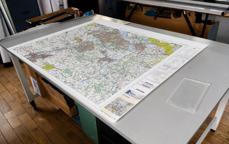
Leader Planning Map
Flat mapping is available where leaders want a larger working surface for route assessment, planning and briefing. Poster and A3 custom map sheets contain mapping with a simple title and scale bar, without a cover, key/legend or notes section.
Best for: route planning, staff discussion and expedition preparation.
Custom Notes on XR, SR, ZR and Multi Trip Maps
These formats include a 7-line text notes area within the legend. The text is customisable and can be used for safety information, contact details, meeting points, expedition instructions or other useful information.
Example notes section
IN THE EVENT OF AN ACCIDENT, KEEP CALM
- Give immediate First Aid & make casualties comfortable
- Sound Distress Signal (6 signals at 1 minute intervals)
- Organise carers & 2 persons to go for help (if possible)
- Locate nearest habitation/Dial 999 for Police/Mountain Res
- Inform condition of injured plus time & place of accident
- Give a Grid Reference & nearest place name or feature
- Inform your Supervisor/Assessor or ask the Police to do so
Mapping Data and Scale
All Aqua3 laminated maps use Ordnance Survey data under the OS Printed Products Licence. Ordnance Survey uses the brand names Explorer for its own 1:25,000 sheet series and Landranger for its own 1:50,000 sheet series. Aqua3 creates bespoke mapping at these scales around the area the customer selects rather than being restricted to a standard sheet centre.
Aqua3's OS mapping data is updated every 6 months. Magnetic information is taken from the current British Geological Survey data set.
How Your Aqua3 Map Is Made
Aqua3 has been developing specialist laminated all-weather mapping since the 1990s. Early work with lamination and film-extrusion companies helped refine flexible films and the production process, which was patented as GB Patent No. 2312869. The materials, machinery and production methods have continued to evolve for specialist all-weather mapping.
Every Aqua3 map is individually prepared and checked, printed, trimmed, hand-fed through the laminator, trimmed again and folded by hand. It is a high-labour process, but it produces a durable working map intended for repeated outdoor use.
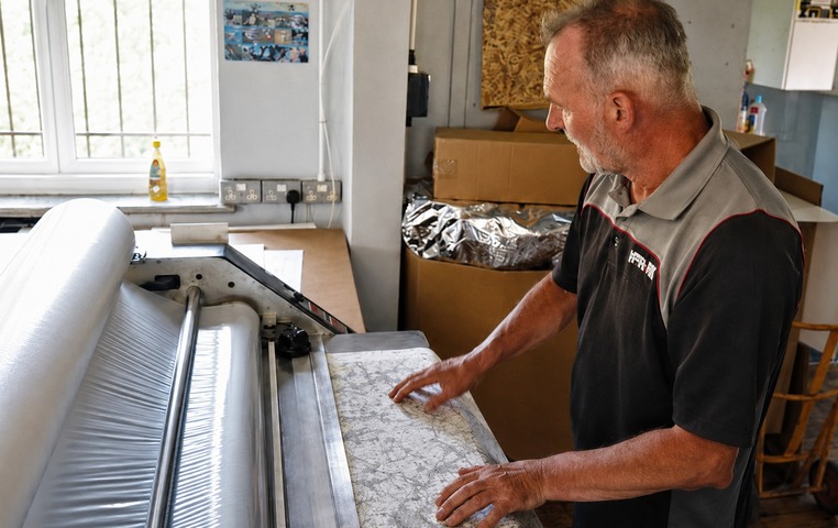
Hand-Fed Lamination
The printed map is fed through the laminator by hand to create the durable waterproof finish.
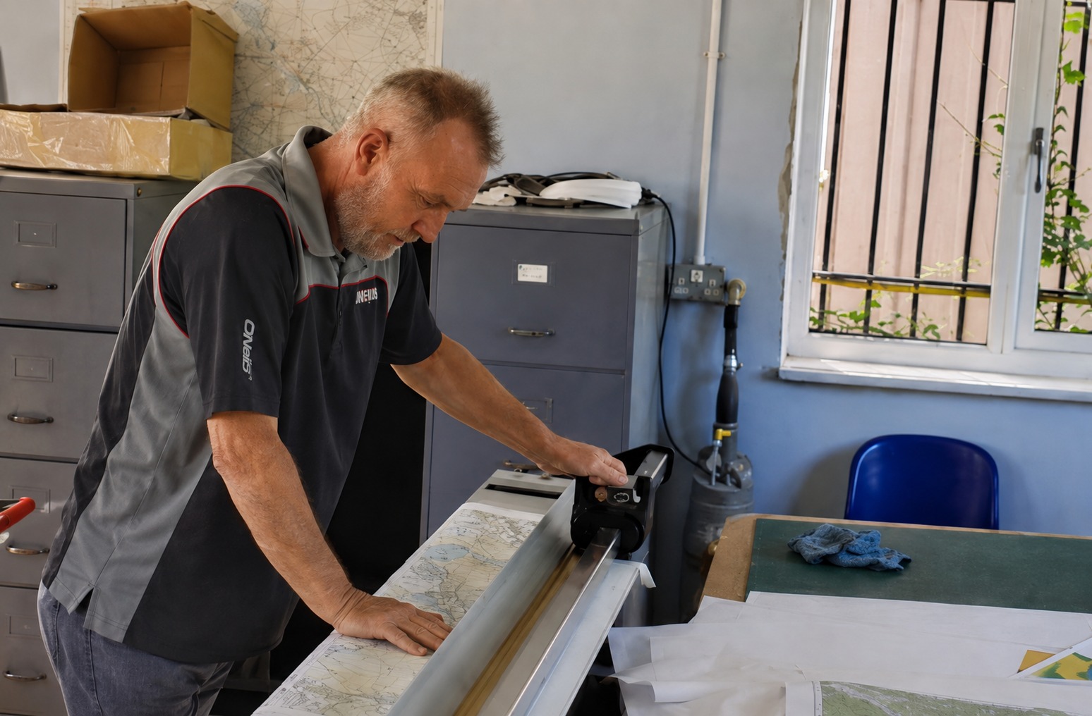
Manual Trimming
The laminated sheet is trimmed by hand as part of the finishing process.
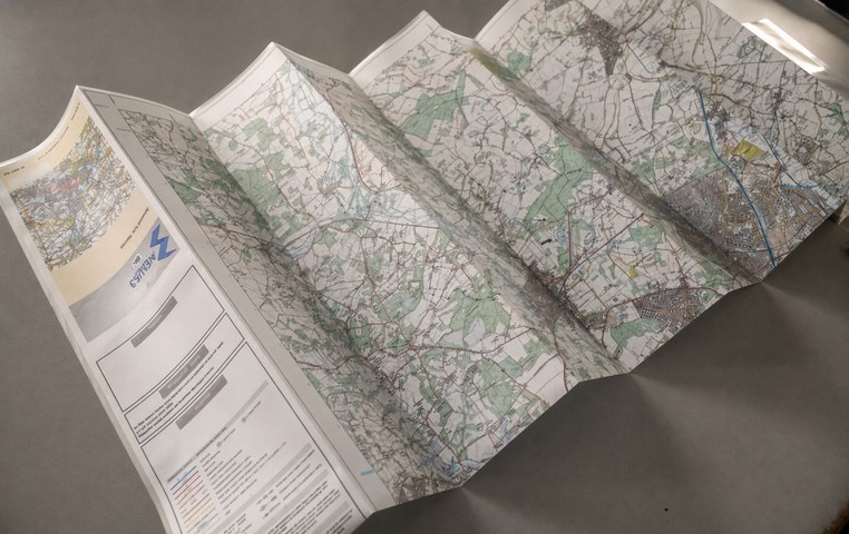
Hand Folding
The finished map is folded by hand into a practical format ready for expedition use.
Made to fold. Made to be used. Made to be used again.
Why the Unique Map ID Matters to Schools
Every Aqua3 map has its own unique Map ID. If your school returns to the same expedition area, quote the existing Map ID and we can identify the mapping previously supplied. This makes repeat ordering much easier and helps schools keep consistent mapping from one expedition season to the next.
Exact Coverage
Choose the area the expedition needs rather than being limited by the centre and edges of a standard map sheet.
Built for Wet Weather
The specialist synthetic print media and laminated finish are designed for repeated outdoor use in British conditions.
Easy to Reorder
Keep the Map ID and the same mapping can be identified again for future groups and repeat expeditions.
Need to See One First?
Sample DofE maps are available to schools and outdoor leaders on request. If you are unsure which size, scale or format is most suitable, contact Aqua3 before ordering.


